Operation Recreation Geotour

Operation Recreation Geotour
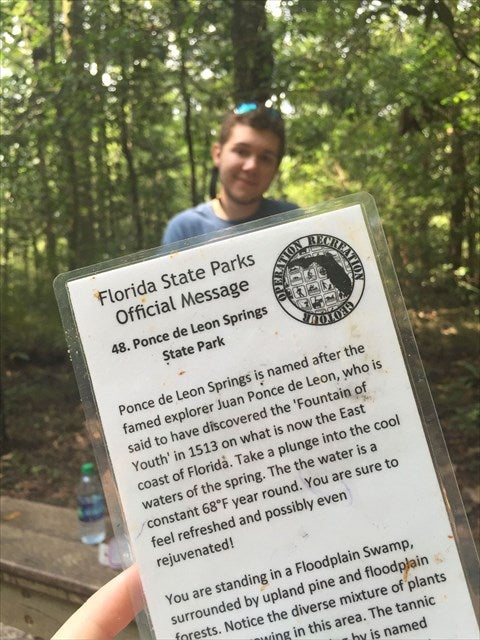
The Operation Recreation GeoTour hosted by Geocaching.com, stretches from Pensacola to Key West and includes 71 of the First Three Time National Gold Medal Award Winning Florida State Parks and Trails.
Visit 20 caches and win the Official Operation Recreation Geocoin. Download and print the Official Tracking Sheet to begin your adventure. Remember to cache and save with unlimited entry for a year with the Florida State Parks Annual Pass.
Operation Recreation Kids GeoTour
The Florida Park Service is proud to announce the launch of the Operation Recreation Kids GeoTour. The Operation Recreation Kids GeoTour challenge is specially designed for children. Look inside Operation Recreation GeoTour geocaches for one of six possible Nature Cards. Every cache has one of six species.
Record the name of the Florida State Park where you first find each of the six species on the Official Tracking Sheet.
Find all six species and win the ORGT Kids GeoTour Geocoin!
Geocaching in Florida State Parks
Geocaching is an outdoor game using hand-held global positioning systems (GPS) devices. It's really an inexpensive, interactive high-tech treasure hunt that's a great way to learn geography.
Participants use location coordinates to find caches. Some caches are easy to find, while others are more difficult. The biggest reward is the thrill of the search and the discovery of a place where you have never been.
Geocaching should have minimal impact to the environment and conscientious land use ethics should be followed.
Florida's state parks are full of opportunities to get outside and explore! And exploration is even more fun these days with the advent of geocaching enabling modern day adventurers to use hand-held global positioning systems to 'treasure hunt' without digging or compromising sensitive natural and cultural resources. Our state parks play host to some of the most scenic locations for caches in the nation. Find out more about geocaching in Florida state parks and be sure to search for caches in our state parks whenever you visit Geocaching.com
How to Find a Cache
Finding a cache is a fun challenge with the correct equipment.
- Sign up for free at Geocaching.com. Enter the zip code for the state park where you are interested in searching. Select "Go." The website will help you find the caches and will provide clues needed for the search.
- Select one or more caches to find.
- Go paperless if your GPS unit allows you to send the coordinates directly to your unit.
- Head to the state park. An entry-fee is usually required for entrance to a state park. Enter the coordinates of the cache in your GPS unit and use the clues provided to search for the cache.
- Each cache usually contains a logbook, pencil and inexpensive trinkets. When you find it, be sure to sign the logbook. If you remove something from the cache, replace it with something of equal value.
- Put the cache back exactly where you found it.
- Share your experience with the geocaching community on www.geocaching.com.
How to Hide a Cache
After you become good at finding caches, you may want to hide one in your favorite spot to see if others can find it. Geocachers are obligated to practice the sport in an honorable and non-destructive manner.
- Find a place to hide your cache that will take a bit of time for another geocacher to find. Select a spot with a great view or an unusual location. Avoid archaeological or historical sites. Those areas are sensitive.
- If you are planning to hide a cache in a Florida State Park, contact the park manager and ask permission for the location you are considering. Describe the location, how you intend to hide it (digging is not allowed) and provide a description of the cache container. The park manager will consider the site attributes and give verbal permission for you to hide the cache in the location. Archaeological, ecological and historical areas are typically off limits. Also consider frequent flooding, fire frequency, animal habitat, etc. before requesting permission.
- Prepare your cache. The container should be waterproof. Put the items in water-tight baggies in case of a leak. Include a small logbook and a pen or pencil. Some people include a note to welcome the cache finder - it's helpful if someone finds it accidentally while others include goodies such as a disposable camera, inexpensive toy, coins or a deck of cards. Mark the outside of the cache so that someone who doesn't play can figure out what it is. Most people mark the container with Geocaching.com, the name of the cache and basic contact information.
- After you have verbal permission from the state park manager, you can place your cache. When you reach the location to place your cache, note the exact coordinates from your GPS unit. Once you have your waypoint, write it in permanent marker on the container and the log book and make sure you have a copy to bring back with you. Write a few notes in the log book if you like, place it in a water-tight baggie and place it in the container. Hide the container. Trail blazing is not allowed.
- Report the cache by filling out the online form at Geocaching.com.
- Maintain the cache. You'll need to return often to ensure that your cache is in good shape. Once people have visited the cache, be sure that other visitors are not disrupting the landscape. If you have concerns, move it or remove it.
GC Codes
- GC38Y93 Fort Clinch State Park
- GC3BG4G Florida Caverns State Park
- GC3D02X Highlands Hammock State Park
- GC3BG4A Hillsborough River State Park
- GC3ABB5 Mike Roess Gold Head Branch State Park
- GC3BG4N Myakka River State Park
- GC3ABBC O’Leno State Park
- GC38Y8V Ravine Gardens State Park
- GC3BG4E Torreya State Park
- GC38Y9F Florida State Parks FINAL CCC Cache located in Highlands Hammock State Park.
Vocabulary
- Cache - A waterproof container that has been hidden by a fellow geocacher, who has posted the GPS coordinates on a website, such as geocaching.com. Some caches are easy to find. They are simply camouflaged. Others may be highly disguised and hard to notice. Virtual caches are simply an unmistakable landmark or park feature.
- Coordinates - A set of numbers that describe your exact location on the earth's surface. Latitude/longitude (lat/long) coordinates are the most typical lines of reference.
- Earthcache - These virtual caches provide Earth science lessons for middle school students. A cache is not hidden, the coordinates of an earthcache mark the location of a significant formation or landscape.
- EcoCache - A 'green' variation of a cache. Placed by geocachers at environmentally significant locations, an EcoCache site helps raise awareness of the role humans play in restoring, preserving and sharing the environment.
- Geocaching - An outdoor game of hide-and-seek using a hand-held Global Positioning System (GPS) unit. Geocachers use location coordinates and a variety of clues to find caches. The visitor may be expected to leave or replace items in the cache or deliver items to another cache. The cache may be a small waterproof box or simply an unmistakable landmark.
- Global Positioning System (GPS) unit - device that reads satellite signals and then, through the use of mathematics, calculates your position on Earth as a latitude (how far north or south of the equator), longitude (how far east or west of Greenwich, UK) and altitude (how far above sea level).
- Travel Bug - item found in a cache that is meant to travel from one cache to another. These are sometimes called 'hitch-hikers.' You can track the location of a Travel Bug at Geocaching.com
- Waypoint - A (usually two-dimensional) coordinate representing a position on Earth.
Useful Websites
Find general information for state parks on each state park's activities page or locate possible geocaches at the following websites:
